
TNF Grant Application for Bypass
Posted: April 28, 2024 Filed under: Uncategorized Leave a commentThe Tahoe National Forest (TNF) has applied to CA State Parks – OHMVR Division for a grant to build two bypasses along the Rubicon Trail.

The larger of the proposed bypasses is 3/4 of a mile long and will go around the shelf road above Miller Creek that could, at any time, though it hasn’t in the last 115 years, slide down into Miller Creek, thus blocking ALL through traffic on the Rubicon Trail.
The smaller reroute goes around “The Water Hole” west of “The Potato Patch” which FOTR and Placer County have both worked on over the years.
My biggest concern is what happens to the original route? At the moment, it is still drivable. Will the FS continue to allow vehicle traffic on the original route until it is no longer safe or even possible? Will it be turned into a single-track OHV route? Maybe a mountain bike trail? Maybe walking traffic only?
My question about possible effects on the ability for Placer County to at some point in the future claim RS2477 rights to the Rubicon Trail were quelled by Amy Granat of CA Off Road Vehicle Association (CORVA). She wisely pointed out that there had already been a few reroute in the past and that this reroute would not prevent Placer County from ‘claiming’ the trail, possibly through an easement, at some point in the future, if they so desire. At this point in time, maintenance and management of the trail are working somewhat well, so why rock the boat. But we don’t lose that possibility.
I reached out to Joe Chavez of the TNF for more details about the plan and for any studies that may have been done under the planning grant. The FS usually does a number of studies for any action: leave as is, fix it, remove it, replace it, etc. I’m curious about possible fixes like cutting in to the wall a foot or two, out sloping the road and protecting the face of the slide from runoff, thus postponing further erosion.
Holly Cow! Joe Chavez got back to me with an awesome response. Detailed and thorough. He also included attachments documenting the route a little better and how some of the construction features. Here’s what he shared…
Hello Mr. Barr,
I will try to address each of your questions to the best of my ability.
Studies –
- Leaving the trail “as is” was ruled out as a viable option, and therefore not studied in detail, since it would eventually lead to the failure of a section of the Rubicon Trail resulting in a physical disconnection of the trail with no immediate option for though traffic. This assessment and conclusion was developed by Geologist William Harris of the California Geological Survey under contract to the OHV Division back in the fall of 2018. Mr. Harris’ expert opinion also recommended that just cutting further into the unconsolidated Lateral Moraine material if a portion of the trail fell away was not a long-term solution as the unconsolidated material would keep slipping due to the undercutting action of Miller Creek. This was the impetus for the search for an alternative route to keep the Rubicon Trail open for the short and long term.
- Repair of the existing route was considered during a field meeting with Forest Service, OHV Division , El Dorado Co staff, including Mr. Harris (Geologist) and Forest Service roads engineer Robert Reugebrink. The conclusion from that visit was that to stabilize that section of trail would require a major “highway” style structure both below and above the Trail, with impacts to Miller Creek. This type of structure would be extremely costly, not fit the character and nature of the trail and would necessitate large equipment to install that would require the incoming Rubicon Trail access to be smoothed out, changing the character of that section of the Trail. So, this was ruled out as reasonable option when compared with rerouting the Trail.
- There was an environmental analysis conducted for the proposed reroute, resulting in the signed Decision Memo. There are additional specialists reports documenting the potential impacts to the natural and cultural resources that I do not have immediate access to. John Brokaw wrote the Decision Memo and should have access to those documents. John, can you please send Doug the specialists reports for the Rubicon Reroute analysis? I am attaching information that gives more detail about the planned construction of the reroute. This will be done in two email to reduce the size of the email to avoid rejection by your email system. This was asked by others and sent to them via email as well.
NEPA – The NEPA is available for the public, not sure if it is online. I will refer to John Brokaw about how one can access the documents. I attached the very simple timeline that is part of the OHV grant application.
Placer County and Reroute – Due to the historic nature of the reroute the Forest Service is not entertaining any actions to decommission the existing route above Miller Creek and Miller Meadow, as well as to keep options open for Placer County. Forest Supervisor Eli Ilano and Truckee District Ranger Johnathan Cook-Fischer have both talked with the Placer County Supervisor for the relevant county district (Eli on multiple occasions spanning several years) regarding the fact that if Placer County wanted to assert jurisdiction or management of the Rubicon through the Tahoe NF, the Forest would work with them. That has not changed. It has been in Placer County’s court for a long time.
The existing route would remain open to hikers and bikers. Keeping the existing route open to motorized uses until the point that the trail collapses was not the initial plan, but the District Ranger is being asked about this option. He has to weigh the potential safety risk of a Jeep or other vehicle triggering a collapse and going down with a slide and any continued impacts to water quality of the existing route (one section has intercepted a spring and is actively downgrading).
Currently, the plan includes the reroute becoming part of 16E75 and would remain open year-round like the rest of the Rubicon per the Tahoe NF Motor Vehicle Travel Management Decision (2010) and the Motor Vehicle Use Map.
Tahoe National Forest would work with Placer County if they are interested in having jurisdiction/managing the Rubicon Trail through the TNF, including the new reroute section.
RS2447 legalities is way above me and a subject for lawyers. I have been learning that it is very complex. It is my understanding that even El Dorado County manages the Rubicon Trail across El Dorado NF via a special use road permit held by the Forest Service. That may be the best option for Placer County if they desire to manage the route.
The 2nd short reroute is proposed to avoid a chronically flooded low section of trail (about 200 feet) and is located in a low flat section of trail below Potato Patch (it is shown on the maps). This would be a new reroute. I cannot find a picture of it at the moment. I will keep looking.
Let us know when conditions allow and we would be happy to look and discuss things on the ground. Expect a 2nd email with more attachments.
Sincerely, Joe
I’m in favor of the big reroute but I think a little more rock hardening of the water hole will be enough to fix any issues in that spot.
There will be a tour of the trail as soon as the snow allows to discuss all of this but that will happen well after the grant comment window closes.
What can you do? Make comments.
The comment period is open through May 6th, 5pm. That’s a Monday.
If enough comments are made about the same concern, the applying agency could rewrite the grant to address those concerns. CA State Parks may formally ask the agency to address the concerns. We have a little power to make some changes but only if you speak out.
Here is a copy of the grant:
Here is a link to the comments page: https://ohv.parks.ca.gov/?page_id=31516
Scroll down to the ‘Tahoe National Forest’ and click to read previous comments.
To make a comment, click on Review Preliminary Application near the top of the page.
Next to the “AGENCY” box, click on the square with the three dots.
Go to page two, scroll down and click on box by “USFS – Tahoe National Forest”
You’ll see “Rubicon Reroute”. Clicking the paperclip icon will get you the text of the grant. Clicking further right on whatever that icon is under “Public Comments” will allow you to comment on the grant.
The state does not allow copies of previous comments to count as another opinion. To make sure your voice is heard, make it your own voice. We can all complain about, or support, the same thing, we just need to do it our own way, different words, better yet, different reasons.
My comments will reflect that we should move forward with the large reroute but take a second look at the smaller reroute and that the original route should be maintained as much as possible and remain open as long as possible.
.
Rubicon Ronin
ENF Delays OHV Trail Openings
Posted: March 28, 2024 Filed under: Uncategorized | Tags: snow, Travel, winter Leave a commentThe Eldorado National Forest has delayed opening our OHV trails until April 15th due to the late and wet storms we are experiencing.
For the purposes of this website, that really only means the Richardson Lake Trail to Sourdough Hill. For what it’s worth, there’s so much snow out there that no one is getting up that trail anyway.
Many trails around Loon Lake and on the west end of the Rubicon Trail will be affected.
 U.S. Forest Service Eldorado National Forest 100 Forni Road Placerville, CA 95667 530-303-2412 www.fs.usda.gov/eldorado U.S. Forest Service Eldorado National Forest 100 Forni Road Placerville, CA 95667 530-303-2412 www.fs.usda.gov/eldorado  News Release For Immediate Release March 28, 2024 Contact: Placerville / Pacific Ranger District: 530-644-2324 Amador Ranger District: 209-259-3774 Georgetown Ranger District: 530-333-4312 www.facebook.com/EldoradoNF Twitter: @EldoradoNF Seasonal Closure of Dirt Roads and Motorized Trails Extended through April 15 on the Eldorado National Forest PLACERVILLE, Calif. – Based on recent and predicted rain and snow, the seasonal closure of dirt roads and motorized trails is being extended through April 15 on the Eldorado National Forest. Using motor vehicles on dirt roads and trails when soil moisture is high can cause damage to roadbeds from rutting, and impaired water quality from excess erosion. A minimum three month closure period from January 1 through March 31 was designated for the core part of the wet season in the Eldorado National Forest Travel Management Plan. This plan also allows the seasonal closure to start earlier or be extended based on actual conditions in a given year. The roads and trails that are subject to the seasonal closure are marked with a “Seasonal Designation” on the current Motor Vehicle Use Maps (MVUMs) for the forest. The MVUMs are available from any forest office or can be downloaded from the forest website at: https://www.fs.usda.gov/detail/eldorado/maps-pubs/?cid=fseprd637014. The seasonal closure does not affect roads and trails in the Rock Creek Area near Georgetown which has its own wet weather closure process. For additional recreation information, contact the Visitor Services staff from 8:00 am to 4:30 pm Monday through Friday: Forest Supervisor’s Office – 530-622-5061Georgetown Ranger District – 530-333-4312Placerville/Pacific Ranger District – 530-644-2324Amador Ranger District – 209-259-3774 ### The U.S.D.A Forest Service is an equal opportunity employer. The mission of the Forest Service is to sustain the health, diversity, and productivity of the nation’s forests and grasslands to meet the needs of present and future generations. News Release For Immediate Release March 28, 2024 Contact: Placerville / Pacific Ranger District: 530-644-2324 Amador Ranger District: 209-259-3774 Georgetown Ranger District: 530-333-4312 www.facebook.com/EldoradoNF Twitter: @EldoradoNF Seasonal Closure of Dirt Roads and Motorized Trails Extended through April 15 on the Eldorado National Forest PLACERVILLE, Calif. – Based on recent and predicted rain and snow, the seasonal closure of dirt roads and motorized trails is being extended through April 15 on the Eldorado National Forest. Using motor vehicles on dirt roads and trails when soil moisture is high can cause damage to roadbeds from rutting, and impaired water quality from excess erosion. A minimum three month closure period from January 1 through March 31 was designated for the core part of the wet season in the Eldorado National Forest Travel Management Plan. This plan also allows the seasonal closure to start earlier or be extended based on actual conditions in a given year. The roads and trails that are subject to the seasonal closure are marked with a “Seasonal Designation” on the current Motor Vehicle Use Maps (MVUMs) for the forest. The MVUMs are available from any forest office or can be downloaded from the forest website at: https://www.fs.usda.gov/detail/eldorado/maps-pubs/?cid=fseprd637014. The seasonal closure does not affect roads and trails in the Rock Creek Area near Georgetown which has its own wet weather closure process. For additional recreation information, contact the Visitor Services staff from 8:00 am to 4:30 pm Monday through Friday: Forest Supervisor’s Office – 530-622-5061Georgetown Ranger District – 530-333-4312Placerville/Pacific Ranger District – 530-644-2324Amador Ranger District – 209-259-3774 ### The U.S.D.A Forest Service is an equal opportunity employer. The mission of the Forest Service is to sustain the health, diversity, and productivity of the nation’s forests and grasslands to meet the needs of present and future generations. |
Winter storms are still coming across the Sierra. If you go out to play, be prepared to spend the night. Bring food, shelter, water, clothing, ham radio, etc.
.
Rubicon Ronin
RTF Update on Reroute
Posted: March 10, 2024 Filed under: Access, Maintenance, Travel | Tags: reroute Leave a commentI posted earlier about this but here it is with more information from the Rubicon Trail Foundation:
I’m of two minds of this reroute. Yes, it needs to happen because one heavy spring rain could wipe out that shelf road. But until it does, I want to keep some form of access to that section of historic trail.
As I mentioned before, the section of the trail just west of 03-04 is not the original trail. Decades ago, the trail was rerouted out of the meadow. So, in reality we’re not losing a half mile of the trail, we’re only losing a couple of hundred of yards of original trail.
It sounds like volunteers will be involved in the building of the reroute. Get on the Friends of the Rubicon (FOTR) email list to stay informed about when volunteers will be needed. I’m hoping they can find some rocky outcroppings to incorporate into the new section of trail. It sounded like RTF wants to make it more than just a dirt road. This should be the link:
.
Rubicon Ronin
It Snowed, a LOT!
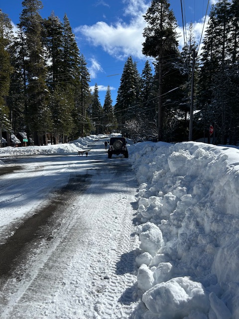
Posted: March 5, 2024 Filed under: Access | Tags: berm, plowing, snow, winter Leave a commentThe drive from Tahoe City to Tahoma on Highway 89 was a little sketchy but at least there was two-way traffic. Once on the side streets of Tahoma, it was a one lane road.

The trailhead didn’t disappoint. With 89 inches of snow falling during the last storm, there was quite a berm at the entrance. The rotary plow had not come through the neighborhood at all. Not only was the berm taller than my truck, once it gets plowed, it will be MUCH taller than my truck.

This shows the width of the berm and that Placer County is still plowing the entrance straight across the entrance.

The locals are up and over the berm, on foot, and skis. It will be some time before a wheeled vehicle makes access.

This is the road off 89 on my way out. That’s 89 in the distance. At least this road was down to the pavement.

I’m not sure when the next storm is coming in but there will be another one.
If you go out, be prepared to spend the night: shelter, food, water, warm clothing, means for keeping warm. Ham radios work all year ’round. Don’t travel alone. Tell someone where you’re going and when you’ll be back.
.
Rubicon Ronin
Same old snow
Posted: February 20, 2024 Filed under: Access | Tags: plowing, snow Leave a commentReports say we’re at 89% of our normal snow fall. The berm at the Rubicon trailhead shows that, but the Homewood ski area was a little light on snow. No one had accessed the trail since the latest plowing that probably happened yesterday.

There appears to be quite the usage going on due to the ruts…

Further up the trail wheeled OHV use is very apparent, along with hikers and cross country skiers.

Placer County may have got the message about not plowing a dip. The current plow is straight down the road so there is no excessive berm at the trailhead.
Although I was in the trail Jeep, I wasn’t about to venture up the trail.

There will be many more storms over the Rubicon. If you go, be prepared for any type of weather. Be prepared to spend the night. Don’t go alone.
.
Rubicon Ronin

